


Guildford satellite firm captures high definition UK space image

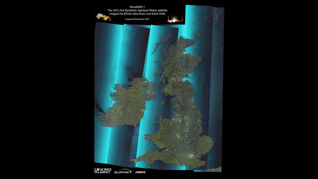
A satellite manufactured in the South East has captured one of the most defined images of the UK from space ever taken.
Surrey Satellite Technology Limited's (SSTL) NovaSAR-1 satellite took seven images in December which have now been processed and stitched together to form a mosaic which covers 685,000 square miles which includes Britain and its surrounding sea.
NovaSAR-1 images using Synthetic Aperture Radar (SAR) which allows the on-board camera to capture high quality images even in cloudy weather with the satellite also possessing a dedicated maritime mode that can detect ship movements.
The image captured in December gives a crystal clear picture of the UK with the country's airports, key bridges, lakes and national parks clearly visible.
A spokesman for SSTL said: "NovaSAR-1 has been optimised with three additional imaging modes, including a six metre resolution imaging mode, for a range of other applications, such as flood monitoring and agricultural and forestry applications. "
NovaSAR-1 is the first SAR spacecraft to be manufactured entirely in the UK with key components manufactured by Airbus Defence and Space in Portsmouth.